
The heat dome from a system of high atmospheric pressure is entrenched over the Four Corners in the desert Southwest on Wednesday. With clockwise air flow around the high pressure, another atmospheric disturbance will rotate along its eastern edge and affect Central Texas.
Wednesday’s weather will be similar to what it was on Tuesday, when showers and thunderstorms began developing around 2 p.m. As they moved into the Hill Country, they became quite strong. The National Weather Service issued a severe thunderstorm warning for Burnet County at one point, and the storm produced a 61-mph wind gust at Inks Lake State Park.
We have a similar weather setup Wednesday with a 50-50 chance for scattered showers and thunderstorms popping up this afternoon and evening. It’s hard to pinpoint where storms will pop up, but if you get caught under one, be sure to seek shelter. They will produce wind gusts as strong as 50 mph and could dump an inch to 1.5 inches of rain with isolated rainfall amounts of up to 3 inches with any slow-moving or training storms.
Temperatures will soar and we may record our 16th day of triple-digit heat this year. The increased humidity will make it feel even hotter, sending out heat index readings to around 102 to 105 degrees.
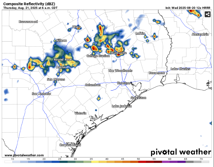
The boundary of a weak cold front will accompany this atmospheric disturbance and stall over Central Texas overnight and into Thursday, increasing rain chances. The latest high-resolution model indicates a cluster of storms will move into the Austin metro area around daybreak, likely slowing morning commutes to school and work. However, other forecast models show these storms diminishing after sunset as we lose the daytime heating that fuels them.
With that in mind, check the latest weather forecasts when you wake up Thursday and before you leave home, as you may want to give yourself extra time to account for the wet roads.